
Discover more from Ag Data News
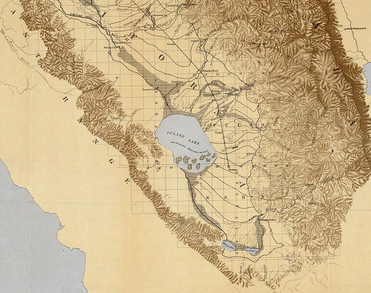
Tulare Lake used to be the largest lake west of the Mississippi River. Beginning in the late 19th century, farmers drained it to grow crops. The lakebed flooded in 1969, 1983, and 1997, but otherwise has served as productive cropland.
This year, it has flooded again and farmers may not be able to plant crops in the lakebed until 2025.
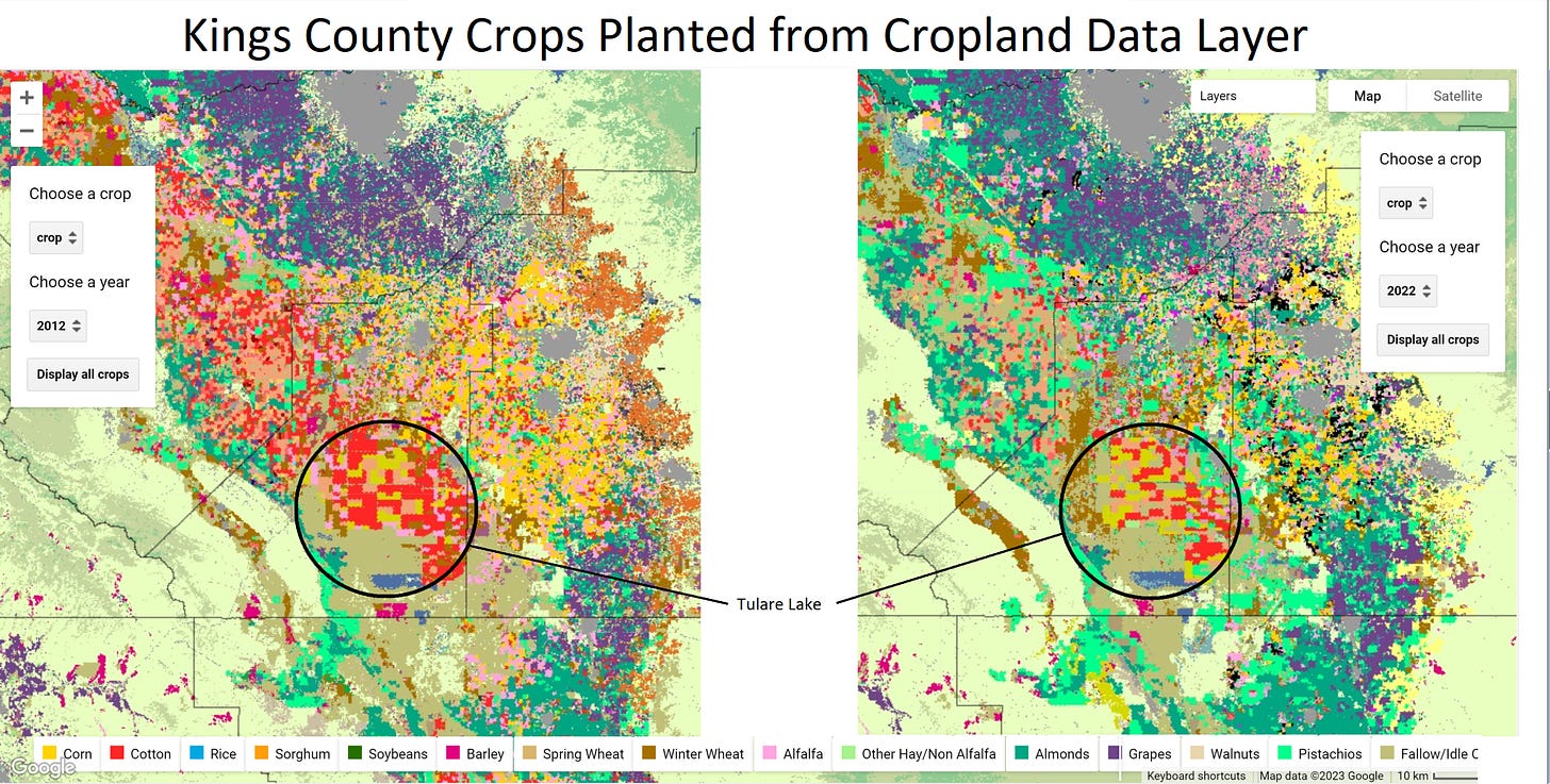
Historically, most of the Tulare lakebed was planted to cotton, but in recent years, there has been an increasing amount of safflower. Satellite data from the cropland data layer (which you can view in our data app here), show 113,000 acres of cotton in Kings County in 2012 and 51,000 acres in 2022. It shows 21,000 acres of safflower in 2012 and 34,000 acres in 2022. The lakebed also contains, tomatoes, wheat, and alfalfa.
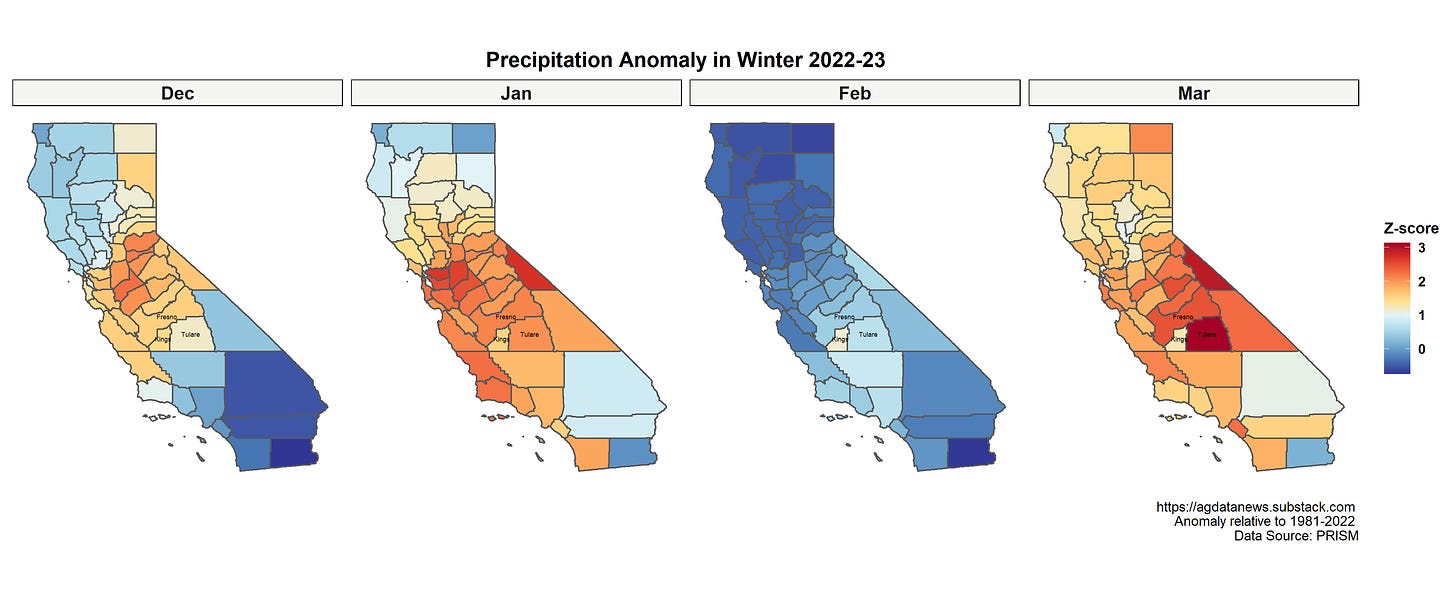
This winter, Tulare and Fresno counties, which lie north and east of the lakebed, received significantly more precipitation than in any year since at least 1980. The lakebed itself lies in Kings County, which typically receives much less precipitation than its neighbors that include the southern Sierras.
Note the very low precipitation in the drought years 2011-15 and 2020-22.
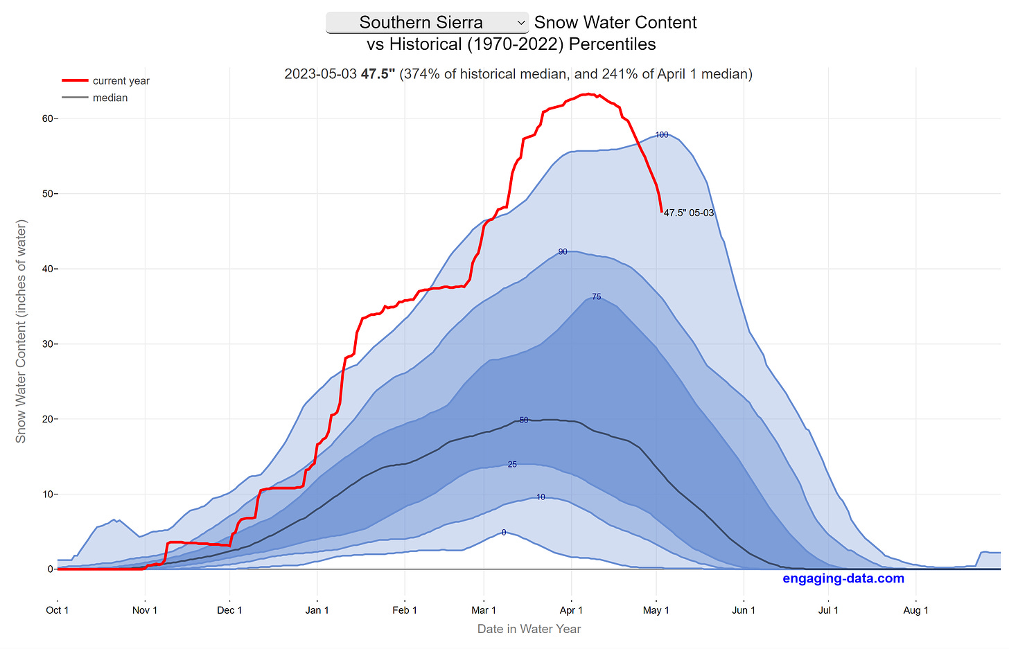
This precipitation generated a record snowpack as of early April. As winter turns to summer, the snow has started to melt.
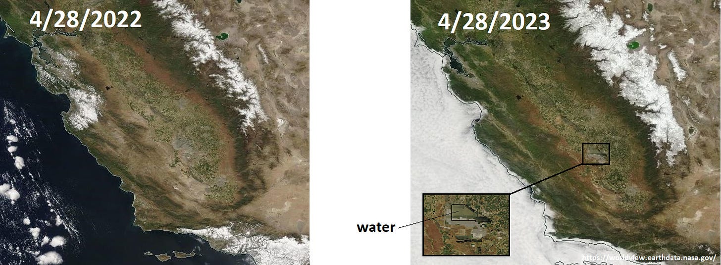
This year's snow pack is about 250% of normal, whereas a year ago it was a quarter of the normal level. When the snow in the Southern Sierras melts, water flows into the southern Central Valley. If the snow melts too quickly, then the valley cannot drain it and Tulare Lake fills. That is what is happening now.
The lake is currently 30-40 thousand acres in size.
Farmers who are unable to plant crops due to Tulare Lake refilling should be able to file crop insurance claims under the prevented planting provision. Prevented planting insurance is "designed to provide protection based on pre-planting costs generally incurred up to the point of planting the crop." A farmer with revenue insurance who had planned to grow cotton in Kings County but was prevented from doing so by flood would get a payout equal to 55% of the guaranteed revenue.
The JG Boswell Company owns one of the largest farms in the US, at about 150,000 acres. James G Boswell started the farm about 100 years ago after moving from moved from Greene County, Georgia, where he had worked as a cotton broker. James, his brother William, and later William's son James G Boswell II, grew the farm into perhaps the largest cotton producer in the world.
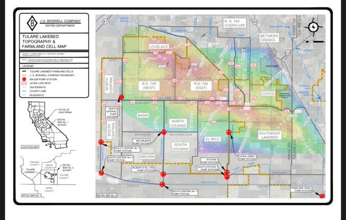
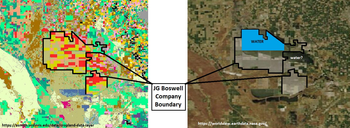
The farm now covers most of the lakebed. To identify Boswell property, I used this map shown recently by the J.G. Boswell Company to the Kings County Board of Supervisors. Satellite images show that most of the current floodwaters are on Boswell land.
Because of its size, Boswell controls a lot of levees and drains and therefore has some control over which land gets flooded. Some farmers have accused Boswell of flooding non-Boswell land so as to plant tomatoes on their own land in the southwest part of the lakebed. Boswell contends that southwest part of the lakebed is higher elevation than the flooded land.
In summary, most of the agricultural losses from Tulare Lake flooding will be borne by one company, but they can mitigate the losses using crop insurance and possibly shift some losses onto others by re-directing the floodwaters.
I made the rainfall graph and map using this R code, and data from the weather data tool that we will release next week(!!!). Stay tuned!
PS: Tulare is pronounced tu-LAIR-ee and rhymes with dairy which, incidentally is the largest agricultural product of Tulare County.







Let the lake live!