Is Texas Taking all the Water?
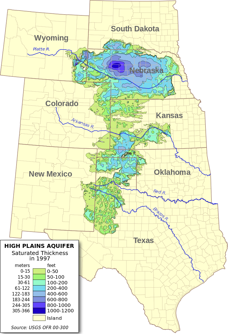
The Ogallala Aquifer runs from the Dakotas to Texas and supplies about a third of the groundwater used for irrigation in the US. Decades of pumping have seriously depleted water levels. "So far, 30% of the groundwater has been pumped and another 39% will be depleted over the next 50 years given existing trends," according to this 2013 paper.
In this article, I focus on the southern part of the aquifer. As we'll see from satellite data, it looks like Texas is taking water from New Mexico.
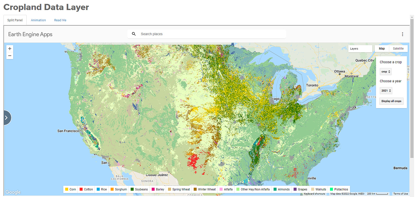
Last week, USDA released the 2021 Cropland Data Layer (CDL). The CDL estimates from satellite images which crop is planted on each 30mx30m pixel in the lower 48 states. Satellites take multispectral images of the earth's surface, and scientists use machine learning to match the spectral profiles of the images to known spectral profiles of crops.
The peerless Seunghyun Lee has updated our CDL data app to include the latest data. Looking at a map of the 2021 CDL, several features stand out. The large yellow and green area in the Midwest is corn and soybeans. The Mississippi Alluvial Plain region shows substantial soybean production along with some rice and cotton. In the west, the multicolored California Central Valley stands out, as do agricultural valleys in Washington, Idaho, and Montana.
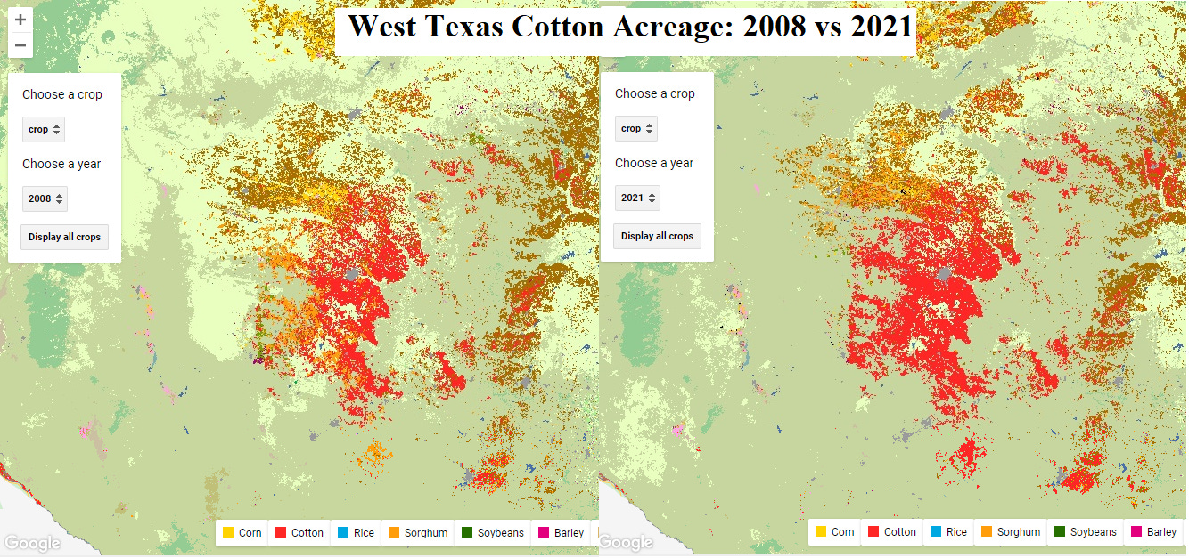
But what most caught my eye was the big red patch of cotton in West Texas.

Since 2008, cotton acreage has increased in west Texas, shifting west towards the New Mexico border.

The trend in Texas differs from the rest of the country, where cotton acreage has halved since 2000. Planted cotton in Texas has ranged between 4.8 and 7.8 million acres since 2000, and in 2021 was near the high end of that range.

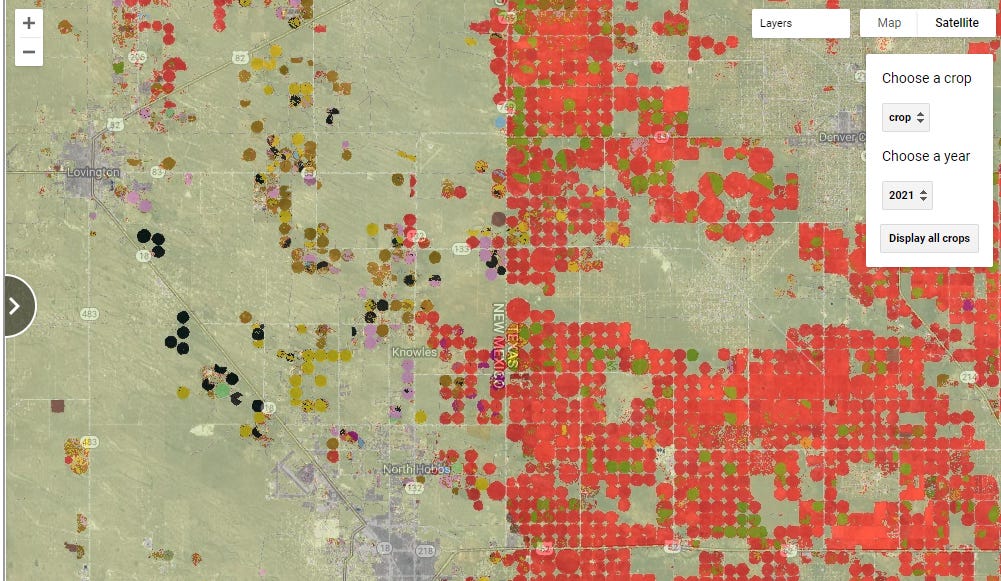
Which brings us to the Ogallala Aquifer and the Texas-New Mexico state border. The red circles on the right indicate fields planted to cotton and watered using large center pivot irrigators. There are a lot of them on the Texas side of the border and very few on the New Mexico side.

What's going on? Is this as simple of Texas taking the water before New Mexico can get it? Such a conclusion would be consistent with this nice paper on over-pumping in the Ogallala Aquifer by UCD ARE alumnus Lisa Pfeiffer and former ARE/ESP faculty member Cynthia Lin Lawell.
Or is there another explanation?
The plots in this article are available for you to view on our CDL data app and our US Crops data app.


